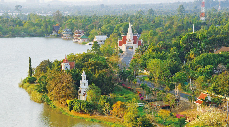
Wat Yan (วัดญาณสังวรารามวรมหาวิหาร) & Chinese museum Wihan Sien
GPS coordinates: 12°47’20.1″N 100°57’28.5″E (12.788907, 100.957928)
Opening hours: 8:00 – 17:00
Entrance: Free. One should be dressed politely. Note that it is operational monastery and you won’t be allowed to visit all objects.
Yanasangvararam Woramahawihan temple has a big territory, that’s why I will list all interesting objects according to logics of moving (in order to escape loops, so you can use this article as a route for self-guided tour).
Contents
- History of wat Yan
- Naga pavilions
- Ariya Metteyya wihan
- Memorial garden
- Replica of Bodh Gaya temple
- Chinese museum Wihan Sien (Anek Kuson Sala)
- Princess Mother pavilion
- Virulhaka shrine
- Ubosot
- Rama VII monument
- Ariyakarn
- Drum tower
- Tripitaka scripture hall
- Chedi Maha Chakripipat
- Dr. Jivaka shrine
- Bell tower
- Mondop & viewpoint
- Map
History of wat Yan
It was Somdet Phra Yanasangwon (1913-2013), who played the significant role in erection of wat Yan – he had initiated and took control over temple’s construction. According to his idea from one hand wat Yan would become big meditation (Vipassana) training centre in proximity to Bangkok, from the other hand it would be a new monastery built in Rama IX reign that would underline the greatness of Thai monarchy. The construction of wat Yan had been started in 1976.
To be honest, Somdet Phra Yanasangwon is ecclesiastical title, not the name. And it’s such a rare title that the monk was the first to obtain it in the last 150+ years (in 1972). So the temple bears his title. In 1989 His Holiness became the 19th Supreme Patriarch of Thailand during the reign of Chakri dynasty.
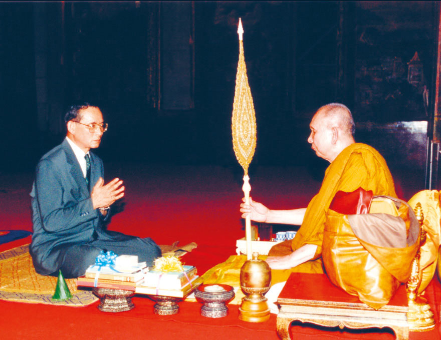
The acquaintance of the king with Somdet Phra Yanasangwon began long ago – in 1956 he was appointed guardian and advisor to Rama 9 during his royal ordination. The king used to invite Somdet Phra Yanasangwon for religious discussions and to take part in Tat Luk Nimit (ceremonies of setting boundary stones) at temples where the monk was serving.
Most of buildings of wat Yan were erected in honour of Thai kings and members of royal family:
- Naresuan the Great (1555-1605) – in 15 years of his reign Siam’s territory became the biggest in history.
- Taksin the Great (1734-1782) – who liberated Siam from Burmese occupation.
- Prachathipok, Rama VII (1893-1941) – during his reign democracy was established in Thailand: absolute monarchy was replaced with constitutional.
- Phumiphon Adunyadet, Rama IX (1927-2016) – current king in that time, who took wat Yan under royal patronage. The king had a lot of merits and achivements, so it’s impossible to fit it in 1 sentence (you can consider this to be the announcement of one of the future articles that will be published on FalkTime 😉 ). And in honour of his relatives:
- Sinakharinthra (1900-1995) and Mahidon Adunyadet (1892-1929) – princess-mother and prince-father, parents of Rama VIII and Rama IX.
- Queen Sirikit (b. 1932) – spouse of Phumiphon Adunyadet.
- Princess Sirinthon (b. 1955) – Rama 9’s daughter.
- Prince Maha Wachiralongkon (b. 1952) – son of Rama IX. Today he is the present king of Thailand, Rama X.
Architecture of temple incorporated many traditions – Buddhist and Hindu, Thai and Chinese, classical components of Southeastern architecture and modern trends.
In 1988 wat Yanasangwararam Woramahawihan was appointed royal Buddhist monastery of the 1st class.
Territory
As in most of religious projects across Thailand numerous benefactors took psrt in construction of wat Yan. Initial 16,07 hectares of land were donated by Dr. Kachon and Mrs. Nithiwadee. Later Nithiwadee family donated another 16 ha. The other land was bought by construction committee and devout followers of Somdet Phra Yanasangwon. The total area of wat Yan is 58,64 ha.
Besides this area there are 400 ha that are attached to monastery. This land belongs to royal-initiated development projects. There are hospital, wildlife breeding centre and agricultural experiments are held.
Agriculture training & career development centre and plant nursery were opened here due to initiative of the king Phumiphon Adunyadet – when he recognized that local farmers face many difficulties. The soil around future monastery was arid and it was hard to grow anything. Also farmers tended to use too many chemicals.
Neighboring projects have not only benefitted local residents but have also greatly improved the monastery’s landscape decorating with pleasant greenery as it is today.
International Naga pavilions
GPS coordinates: 12°47’41.6″N 100°57’09.2″E (12.794892, 100.952547)

8 pavilions in different architectural styles were erected on the bank of water reservoir on the occasion of the 50th anniversary of Rama 9 (in 1977):
- 3 by Thailand in styles of Central, Northern and Northeastern regions.
- 2 by Singapore.
- 1 by India.
- 1 by Japan.
- 1 by Switzerland.
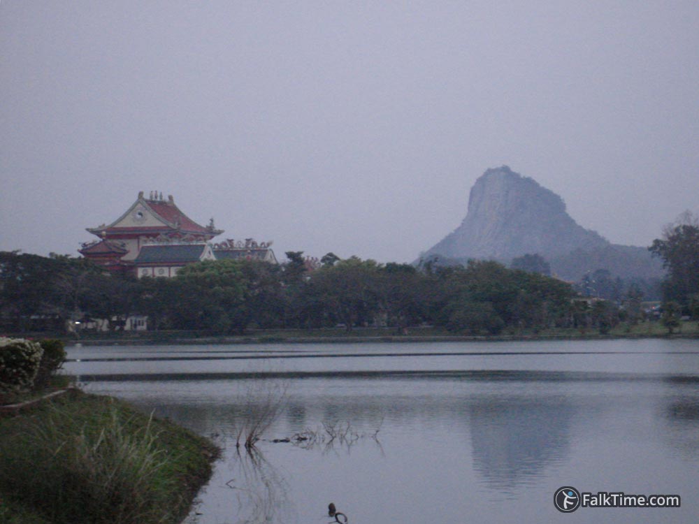
Here you can enjoy view to Khao Chi Chan. It doesn’t matter that the rock is more than 3 km away – Buddha image is still easy to see.
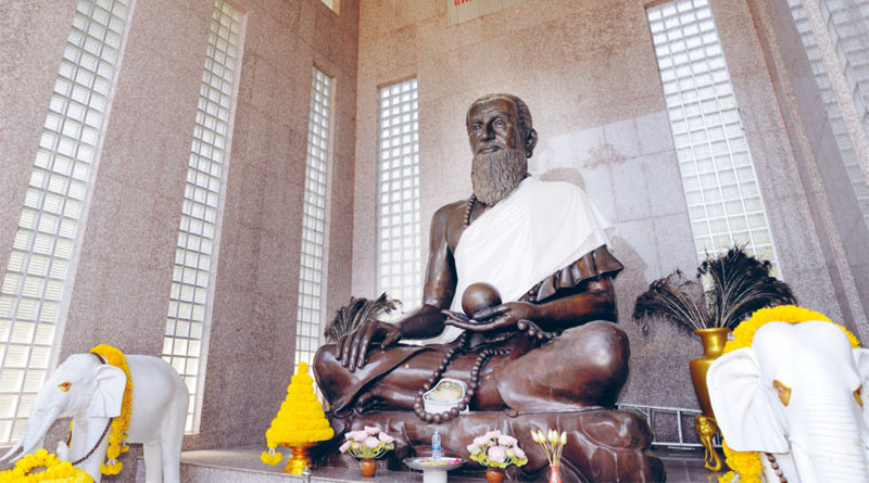
Ariya Metteyya wihan
GPS coordinates: 12°47’23.0″N 100°57’26.0″E (12.789719, 100.957207)
Metteyya is regarded as a Buddha who will appear on Earth in future according to Buddhist belief. The work over creation of main Buddha image for this wihan began long before construction of monastery – in 1964 national artist Fuea Haripitak had started to create the sculpture from the vision perceived by Pranart Tattanond (who was also a sponsor of crafting). The statue had been finished in 20 years and it was presented to the king, who ordered to install it in Ariya Metteyya wihan.
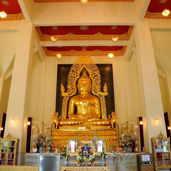
Buddha sculpture is made of 84 044 bronze lids of alms bowls. The symbolism hides in:
- 84 000 Buddhist dharma teachings
- 12 zodiac signs
- 32 human organs
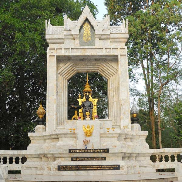
Memorial garden
GPS coordinates: 12°47’22.7″N 100°57’28.3″E (12.789631, 100.957865)
The garden next to Ariya Metteyya was created in order to commemorate princess-mother Si Nakharinthra and prince-father Mahidon Adunyadet. Following coordinates you will reach their monument. A few meters away there’s a monument of the princess, when she was 90 y.o. Creation of memorial garden was completed in 1999.
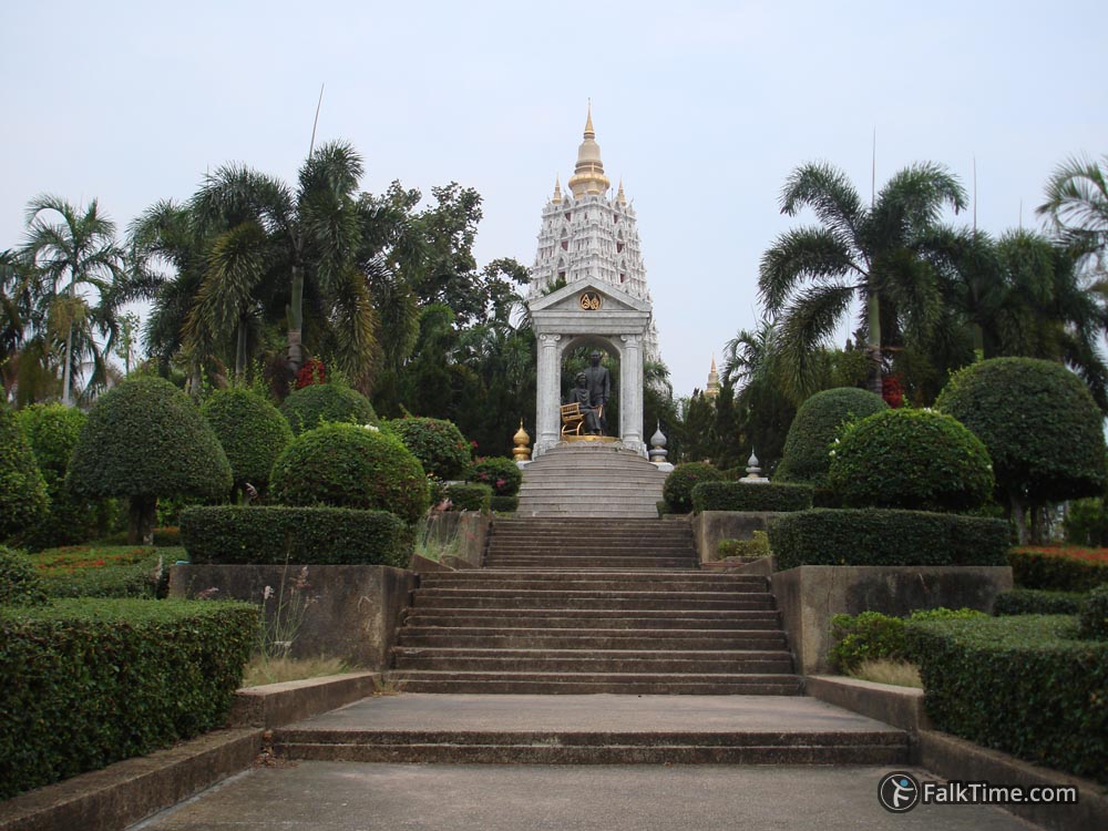
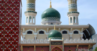
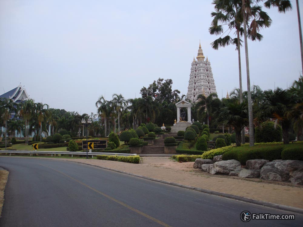
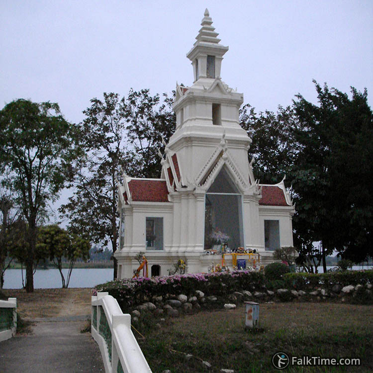
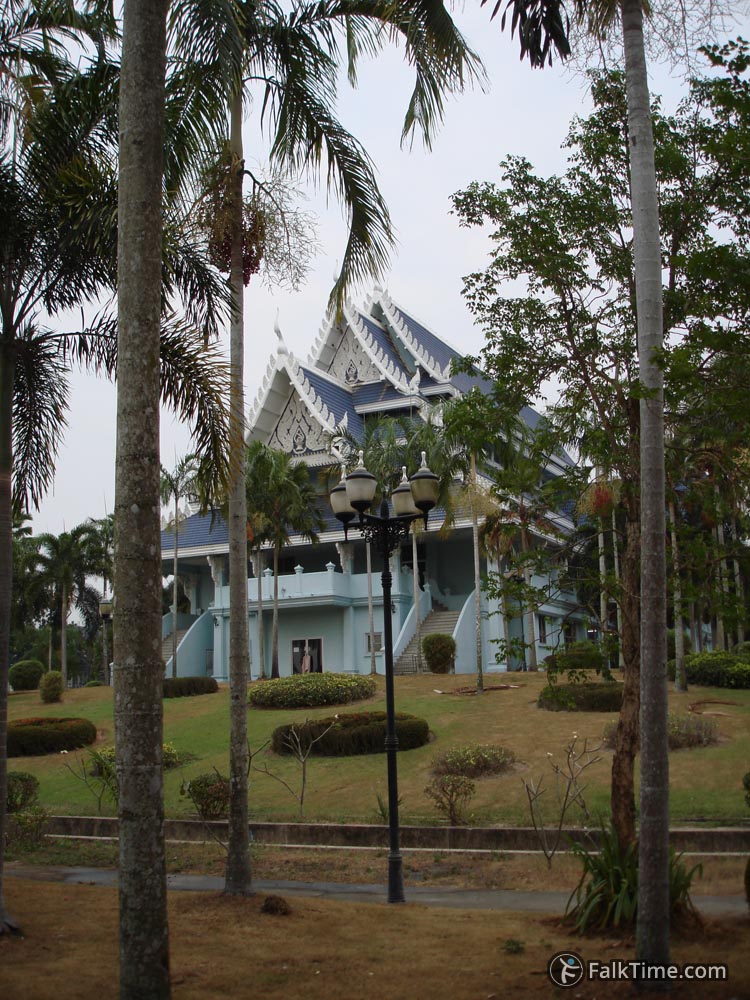
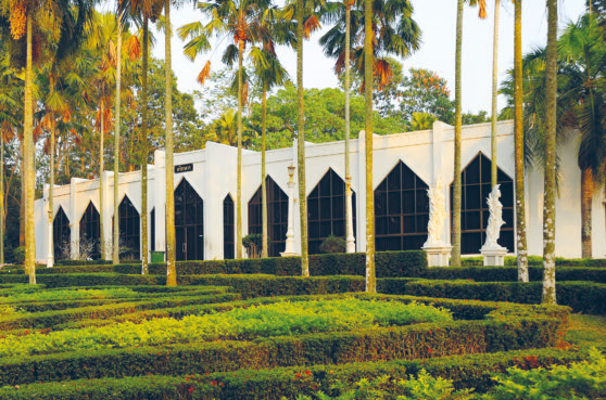
Replica of Bodh Gaya temple
GPS coordinates: 12°47’20.1″N 100°57’28.5″E (12.788907, 100.957928)
To be exact, it’s replica of Buddhist temple Mahabodha from Indian town of Bodh Gaya. His Holiness asked architect Mitrarun Kasemsi to build something in honour of Lord Buddha only. The architect decided to adapt design of original Indian temple.
Thai replica is twice smaller (~27 meters high, when original temple’s height is 55 m). You can visit permanent exhibition on the topic: “What did Buddha discover from his enlightenment?” on the ground floor of temple. The entrance is free, but you won’t be allowed to go higher than this floor.
Wihan Sien museum (วิหารเซียน)
Also known as Anek kuson Sala (อเนกกุศลศาลา).
GPS coordinates: 12°47’16.3″N 100°57’18.9″E (12.787855, 100.955244)
Entrance: 50 THB
Now it’s time to make a little loop and visit 3-storeyed wihan Sien. Museum was built according to fengshui principles in 1987 to celebrate the 60th birthday of His Majesty. Here one can see Thai and Chinese religious & mythological art, traditional musical instruments, ancient pottery, model of ship and many other interesting exhibits.
The highlight of collection definitely are several soldiers and horses from Terracotta Army (the very Army discovered by the tomb of the first Emperor of China, Qin Shi Huang, next to Chinese town of Xi’An).
When you’re done with museum, you should return back to the territory of wat Yan in order to continue sightseeing route.
Princess-mother pavilion
GPS coordinates: 12°47’20.7″N 100°57’31.6″E (12.789078, 100.958783)
The pavilion was erected in 1990 in honour of princess Sinakharinthra (mother of kings Rama VIII and Rama IX) on occasion of her 90th birthday. There are wax figures of 90 y.o. princess and of princess and her husband (replicas of monuments that you’ll see in memorial garden) and of course the golden Buddha. Nowadays this pavilion is used for training of young Buddhists and for large groups that attend Dharma training sessions.
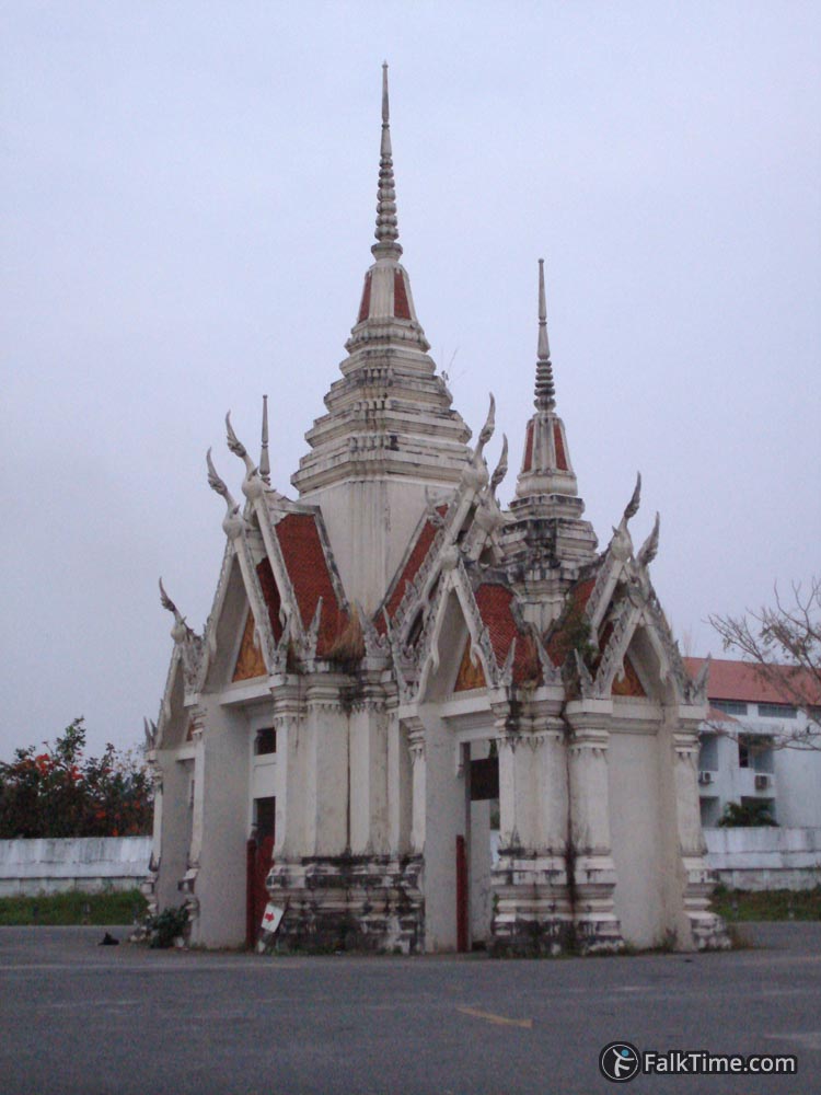
Virulhaka shrine
GPS coordinates: 12°47’29.0″N 100°57’30.8″E (12.791393, 100.958545)
Virulhaka is one of 4 Heavenly Kings that watch over cardinal directions of the world (they are worshiped by Chinese Buddhists). He is responsible for the South. Virulhaka was highly respected by benefactors of wat Yan and his shrine was erected by architect Mitrarun Kasemsi for success of the project.
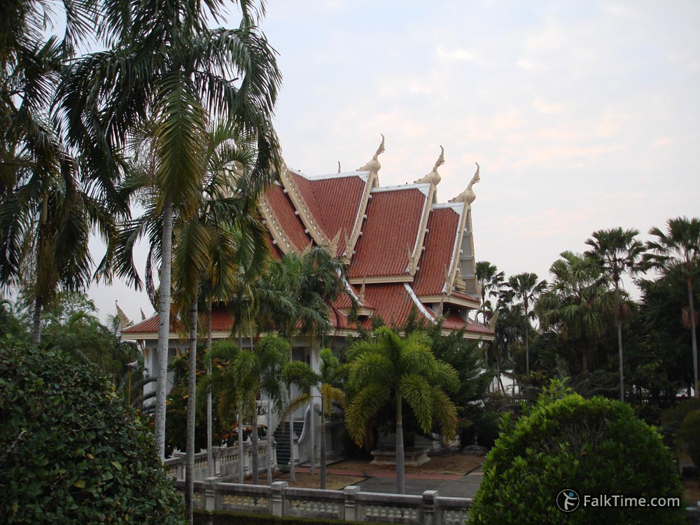
Ubosot
GPS coordinates: 12°47’23.2″N 100°57’35.7″E (12.789776, 100.959906)
Main ceremony hall of wat Yan was built with the front facing the sea and its back facing hills in order to gain prosperity and fortune. In front of the entrance you will see 2 sculptures of panthers. Once after ceremony soldiers that assisted with construction of hall have noticed 2 panthers walking around site. In the morning their footprints were found. The same happened 3 days, night by night, and then panthers disappeared. Superstitious Thais decided to ask the sculptor Mod Wongsawat to make a reminder of this event.

Rama VII monument
GPS coordinates: 12°47’27.5″N 100°57’38.9″E (12.790957, 100.960814)
King Prachathipok, Rama VII (08.11.1893 – 30.05.1941) had been ruling Siam only 10 years. But this time was enough for changes – he agreed to replace absolute monarchy with constitutional. So the revolution appeared to be bloodless.
Ariyakarn
GPS coordinates: 12°47’25.8″N 100°57’38.7″E (12.790503, 100.960735)
Museum with 24 wax figures – 22 holy monks and 2 eminent laywomen.
Drum tower
GPS coordinates: 12°47’23.6″N 100°57’38.7″E (12.789875, 100.960759)
Drum tower’s prototype was Mahakan fort in Bangkok.
Tripitaka scripture hall
GPS coordinates: 12°47’23.0″N 100°57’40.2″E (12.789734, 100.961175)
The building is surrounded by a pond – it’s traditional Thai way to protect holy scriptures from ants and other insects. Architectural style of wat Yan’s Tripitaka scripture hall was borrowed from wat Phra Singh in Chiang Mai province.
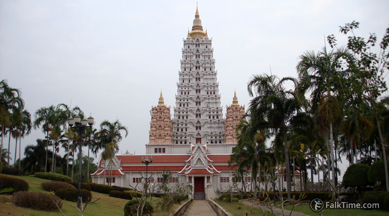
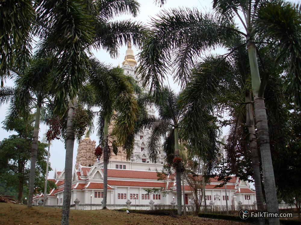
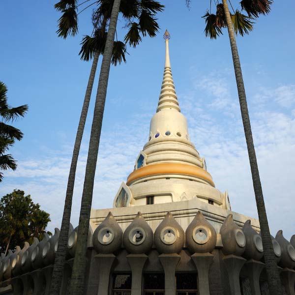
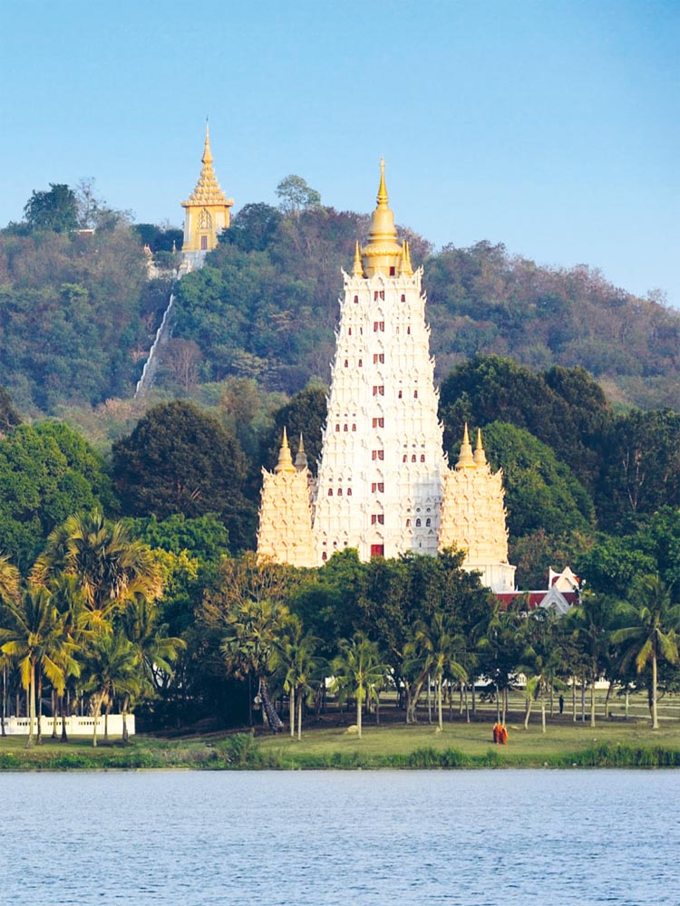
Chedi Maha Chakri Pipat
GPS coordinates: 12°47’20.5″N 100°57’39.2″E (12.789021, 100.960883)
39-meter chedi consists of 3 floors. Groundfloor is used for temporary exhibitions, first floor contains copy of Buddha’s footprints, second floor houses holy relics of Buddha and his disciples.
Ceremony of stone laying was held in 1982. His and Her Majesties took part in it. Phumiphon Adunyadet named chedi: “Stupa that contains Buddha’s relics for progress and stability of Chakri dynasty”. The top of chedi is decorated with 3 Phra Maha Chakri royal emblems.
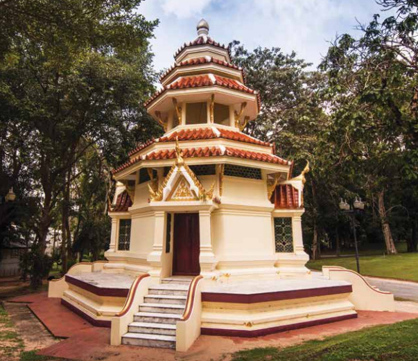
Dr. Jivaka shrine
GPS coordinates: 12°47’18.3″N 100°57’40.3″E (12.788427, 100.961205)
Indian doctor Jivaka Komarabhacca is much revered in Thailand – as Buddha’s personal doctor and as founder of Thai medicine and Thai massage.
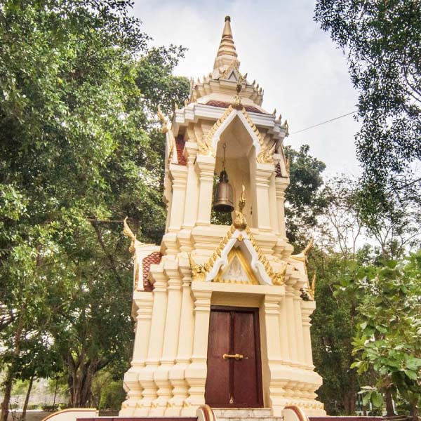
Bell tower
GPS coordinates: 12°47’20.0″N 100°57’36.4″E (12.788875, 100.960123)
Every morning a monk rings a bell at 4 a.m. to wake up everyone in monastery for morning meditation and praying.
Now you’ll have to walk a little bit more than 1 km to reach mondop staircase, where you’ll continue the exercises. 😉
Mondop & viewpoint
GPS coordinates: 12°47’08.1″N 100°57’57.1″E (12.785583, 100.965850)
Phra Maha mondop was erected on the top of Khao Keo hill. One needs to climb 200 steps to reach it (traditionally long nagas crawl along the staircase). The view that one will see from mondop will be worth climbing.
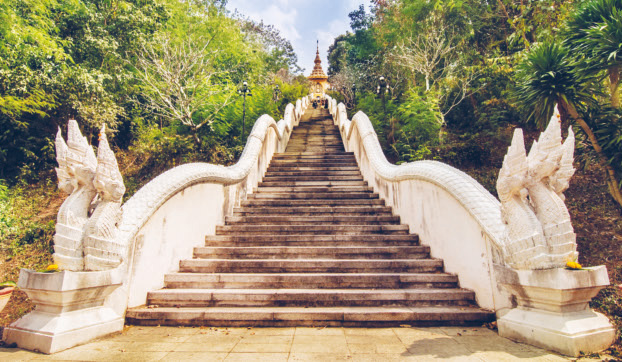
Mondop was founded in 1984, the main relics here are Buddha’s footprints. Also here are 4 Buddha statues:
- Buddha descending from heaven – in honor of His Majesty Phumiphon Adunyadet.
- Contemplating Buddha – in honor of Queen Sirikit.
- Blessing Buddha – in honor of Taksin the Great.
- Buddha opening up 3 worlds – in honour of king Naresuan.
Golden mosaics that decorates mondop previously was decorating chedi of wat Phra Kaew. During restoration in 1982 it was replaced with new Italian mosaics. And economical Thais decided to give new life to the beautiful finishing material, why should one waste it? (Especially when it comes from such a holy place).
The author of sculptures (4 Buddhas, Buddha’s footprints inside mondop and a composition at the foot of staircase) is Mod Wongsawat, who achieved the title of national artist in visual arts in 1988.
Map
As you see from the map, wat Yan is located outside Pattaya and public transport doesn’t reach it. Actually it’s hard to find something to hire here to. So I would suggest you 2 options:
- the easiest – grab a taxi (songthaew or motorbike) and reach an agreement with driver that he’ll pick you up in the area he had brought you to at specific time;
- the second – to rent a vehicle and drive on your own.
If you still have time (and you are in right mood), you can continue sightseeing. Not far from wat Yan you will find:
They are too far to go there on foot, so you’d rather grab a taxi to get there (if you haven’t rented a car/motorbike).
Take Pattaya map with you – just click the star and it will be saved in your Google account. Any locations in this region that I will add later will appear on your map.
Source of pictures without FalkTime watermark: official website of wat Yan.